Topographical Surveys
Offering a wide variety of traditional Land & Underground Surveying services. With over 15 years experience in the surveying industry, our services will prove to be both timely and effective.
What You Can Expect – Our Service Timeline
Our Highly experienced surveyors can rapidly and precisely capture feature detail using a combination of Total Station, GNSS and powerful 3D laser scanners. All features are shown to a level of detail and scale appropriate to the individual project.
Equipments we use
Robotic Total Stations (e.g. Leica, Trimble) for high-accuracy angle and distance measurement
GNSS Receivers (RTK-enabled) for geospatial positioning tied to National Grid
3D Laser Scanners for dense point cloud capture of terrain and built features
Digital Levels for precise elevation readings and spot height verification
Field Tablets & Controllers with live data capture and on-site verification
On-site Survey (1–2 days)
Our surveyors use Total Station, GNSS, and 3D laser scanners to capture precise 3D data on-site.
Surveys referenced to any specified Grid and Datum (commonly OS Grid) using GNSS
Every survey point recorded in XYZ, enabling level contours and spot heights
Rapid and detailed feature capture for both natural and man-made structures
Experienced team ensuring tight tolerances and reliable measurements
Post Processing (1 day per survey day)
Collected data is transformed into accurate, industry-compliant plans and models.
Surveys referenced to any specified Grid and Datum (commonly OS Grid) using GNSS
Every survey point recorded in XYZ, enabling level contours and spot heights
Rapid and detailed feature capture for both natural and man-made structures
Experienced team ensuring tight tolerances and reliable measurements
Delivery
We package and deliver your survey data in the format and style you need.
Surveys referenced to any specified Grid and Datum (commonly OS Grid) using GNSS
Every survey point recorded in XYZ, enabling level contours and spot heights
Rapid and detailed feature capture for both natural and man-made structures
Experienced team ensuring tight tolerances and reliable measurements
Topographical Survey Projects that we have worked on
Established by our Managing Director Calvin Scouler in late 2016, CMS Surveys Limited has rapidly grown into one of the UKs leading surveying companies.
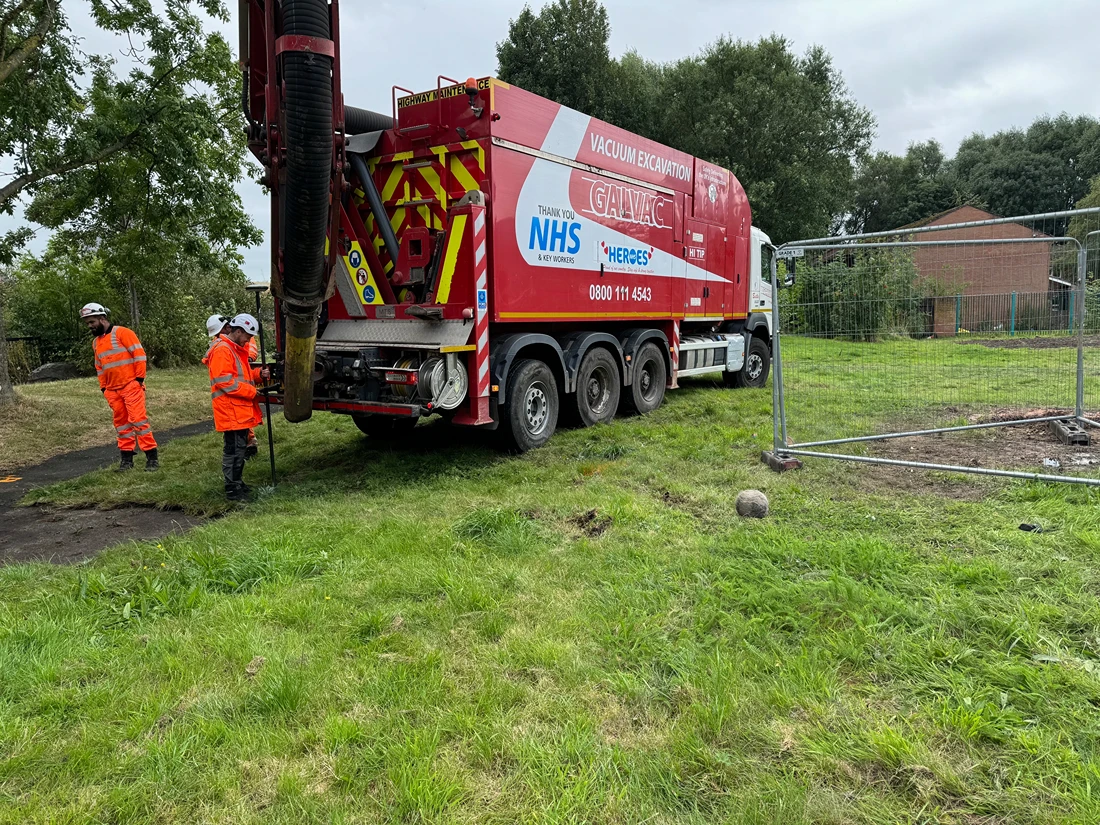
Contact UsGalvac Vacuum Excavation
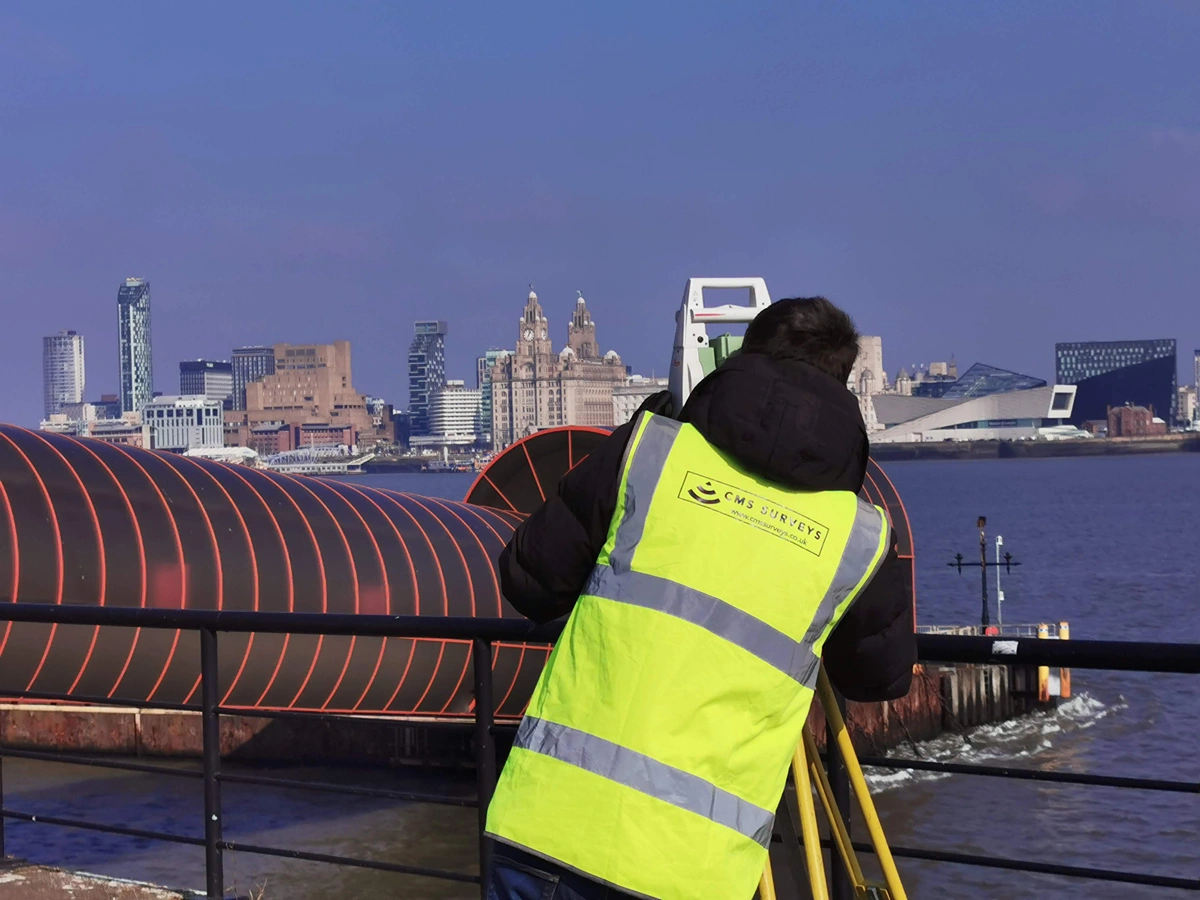
Liverpool Docks
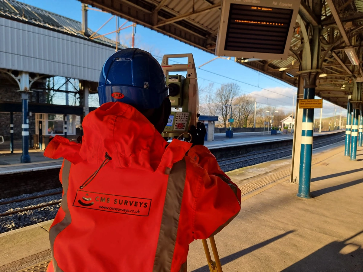
Speke Train Station
Excellent Experiences Shared by Our Clients
Let's Survey Together
Request a Quote Today – Fast, Accurate and Trusted Land & Underground Surveying Services Backed by Over 15 Years of Industry Experience. Let’s Get Started.
Contact Us